
Remote sensing advances: ACP countries can do more
-
Paul Geerders, consultant
-
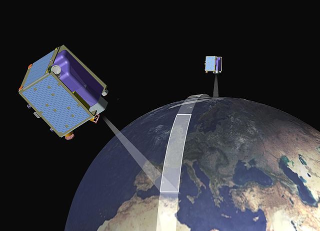
Remote Sensing from space and from airborne platforms has become an efficient method to obtain data about ecosystems and environment parameters over wide regions, frequently, over a long time, and with high spatial and temporal detail. Data derived from Remote Sensing observations provide a consistent view of the dynamic nature of the Earth’s ecosystems and environments, allowing the detection, identification and mapping of changes. The synoptic view over time and space makes it possible to visualise and understand ecosystems and environments in new and exciting ways, and contribute valuable information to facilitate the decision-making process.
Over the last decade, Remote Sensing has developed in various ways, strongly increasing its potential as a tool to support integrated agricultural management and sustainable rural development. First of all, geometric or spatial resolution has improved which implies that smaller details on the ground become visible, allowing for a better view of vegetation and its surrounding environment. Second, the improvement of the radiometric or spectral resolution combined with the integral use of information from different spectral channels allows a more accurate analysis and interpretation of the Remote Sensing data in terms of: type of crop, soil type, state of growth, and presence of disease. Moreover, this aspect facilitates the use of Remote Sensing data under less favourable atmospheric conditions. Thirdly, the number of operational Remote Sensing platforms is growing, which allows for almost continuous monitoring at a worldwide scale. Finally, the internet with its ever increasing capabilities has strongly facilitated the availability of Remote Sensing data and derived data and information products to users, even in remote places.
Besides sophisticated platforms, such as earth observing satellites and large, instrumented aircraft (for photogrammetric and cartographic applications), small aircraft, balloons and zeppelins, kites, remote controlled model aircraft and microlights are increasingly used in ACP countries as alternative, cost-effective platforms for aerial Remote Sensing observations. In many situations, these platforms have proven to be very practical and cost-efficient, as well as easy and fast to implement in case of emergencies, such as forest fires and floods, to obtain a rapid overview of the situation in support of rescue operations.
Satellites help countries to fulfil reporting commitments, such as under the United Nations Framework Convention on Climate Change and Kyoto Protocol relating to carbon sinks, and the destruction, planting and regeneration of forests. Other land cover and land use change applications relate to desertification, drought, forest fire risk and food security problems. Earth observation also supports fishing activities and policy, in order to sustainably manage fish stocks, and to identify suitable areas for fish farming. Its great value for disaster management and mitigation has also been demonstrated for instance in relation to the tsunami disaster in the Indian Ocean of 2004 and the tsunami in Japan in 2012.
Successful application of Remote Sensing in an ACP country requires a full chain of technologies and expertise from the acquisition of the Remote Sensing data (either by purchase, downloading or direct reception), through processing and generation of information products, to distribution of these information products to specific users and their applications. This requires considerable investments for the acquisition and processing of Remote Sensing data, and for converting these data into specific, dedicated information products for science and governance. An appropriate organisational structure needs to be in place to effectively manage each component of this chain. The chain could be fully operated and funded either by the government or by private industry, or – more and more common – in a public-private partnership.
Space is basically free, and earth-orbiting satellites, operated by a small number of countries, continuously make detailed observations of the territory of each and every country in the world. However, such observations have military and economic value and should not necessarily be freely available to everyone. Therefore, international agreements have been developed and implemented by the UN Committee on the Peaceful Uses of Outer Space, including a ‘data policy’, to regulate the distribution of and access to Remote Sensing data, in order to protect the interests of each country.
Current Situation in ACP Countries
In most ACP countries, Remote Sensing data are available for research and decision-making. Free Remote Sensing data, free software for image processing and freeware geographic information systems (GIS) can easily be downloaded from the internet. Examples include: UNDP's Environmental Data Explorer and GLOVIS of USGS. However, this does not imply that each and every technology is 'appropriate' for a specific ACP country or for a specific application, and consequently the available data and information are not being used to their full capacity. Only a thorough analysis of the requirements of the users, as well as of their enabling environment can achieve an optimum tuning of the data and information products to the application.
Successful initiatives have been implemented to build capacity on the use of Remote Sensing, driven by government requirements, universities and private industry. In this context several regional centres were established in Africa (the AGRHYMET Regional Centre (ARC) in Niamey, Niger; the Regional Centre for Mapping of Resources for Development (RCMRD) in Nairobi, Kenya; and the Southern African Development Community (SADC) Regional Remote Sensing Unit (RRSU) in Gaborone, Botswana). Moreover, several governments made important investments in the development of dedicated software. National and regional networks have been established such as the African Association of Remote Sensing of the Environment (AARSE), the SELPER network for Latin America and the Caribbean, and the APAN network for Asia and the Pacific. Now it is time to shift the focus to the operational inclusion of Remote Sensing information in governance processes. Continued exchange and cooperation can help ACP countries to potentially profit from this technology for their sustainable development and participate in its further development.
For ACP countries, it remains important to continue to invest in strengthening the existing technical infrastructure, raising awareness and providing training on Remote Sensing to policymakers and their advisors, to general users and to the academic community. In this way, an important contribution is made to the essential data and information base for governance relating to agriculture and rural development. Moreover, it is expected that ACP experts will play an increasingly important role by influencing the choice of satellites and sensors of future Remote Sensing space systems to ensure that present and future requirements of ACP countries are adequately met.
European initiatives
Europe’s earth observation programme, known as Copernicus (previously Global Monitoring for Environment and Security – GMES), is an EU-led initiative in partnership with the European Space Agency (ESA). Currently in the early stages of its implementation, Copernicus will produce data to inform national and local level environmental policymaking and to support environmental monitoring, policy evaluation, modelling, forecasting and reporting. It is intended that the programme will make key contributions to EU flagship initiatives, including Resource-Efficient Europe, which focuses on securing Europe’s needs in terms of natural resources, such as food, soil, water, biomass, ecosystems, fuels and raw materials.
Building up the knowledge base is defined as a priority in both the communication on “A resource-efficient Europe” and the new EU Environment Action Programme to 2020. Copernicus can be considered as a building block together with other EU initiatives, such as SEIS (Shared Environmental Information System) and INSPIRE (Infrastructure for Spatial Information in the European Union).
As a member of the Group on Earth Observations (GEO), the European Commission is also collaborating with 88 participating governments, including several ACP countries, to build a worldwide network of EO systems – a Global Earth Observation System of Systems (GEOSS) – which will provide decision-support tools to a wide variety of users. GEOSS will be a global and flexible network of content providers allowing decision-makers to access an extraordinary range of information at their desk. GEOSS will proactively link together existing and planned observing systems around the world and support the development of new systems where gaps currently exist. It will promote common technical standards so that data from the thousands of different instruments can be combined into coherent data sets. The ‘GEOPortal’ offers a single internet access point for users seeking data, imagery and analytical software packages relevant to all parts of the globe. It connects users to existing databases and portals and provides reliable, up-to-date and user friendly information – vital for the work of decision-makers, planners and emergency managers. For users with limited or no access to the internet, similar information is available via the ‘GEONETCast’ network of telecommunication satellites.
Conclusion
Although the potential of Remote Sensing technologies or methodologies has been demonstrated through pilot and demonstration projects, only a few ACP countries have advanced to operational applications for agriculture and rural development. Major limitations include: the limited availability of software, hardware and communications infrastructure; lack of data; incompatibility of information products with applications; and high cost. Strengthening the capacity of ACP countries to fully profit from Remote Sensing data requires investments in the development of dedicated information products for decision-makers, and the availability of the required software, hardware and communications infrastructure to generate and disseminate the information products.
The scientific community can play a decisive role in the development of dedicated information products on ecosystems and environment to identify relevant impacts and changes: natural and man-made. Moreover, numerical models describing the relevant processes of environment and ecosystems can be developed to generate forecasts of future changes and impacts. The integration of numerical models in a 'virtual environment' allows for simulating planned impacts (e.g. the construction of a dam or a channel, or implementation of certain management or policy decisions), assessing the possible consequences of different scenarios and supporting the selection of the best alternative.
Several ACP countries have developed national policies for conserving and protecting natural resources and biodiversity to meet their obligations under relevant international agreements and conventions, e.g. Agenda 21, the Convention on Biological Diversity (CBD) and the Kyoto Convention. However, large differences exist in the level of implementation.
Small and Medium Enterprise (SME) in the ACP countries have become active in Remote Sensing and GIS. Inspired by their counterparts in Europe, the United States and India, several SME’s now act as operational providers of dedicated information products to governments, the agricultural industry and other relevant industries (consultants, construction). However, each country has its specific limiting conditions influencing the practical implementation of the SME approach: the policy and legislative framework, the educational level and skills of the human resource base, the physical infrastructure in support of scientific pursuits, access to and capacity to capitalise on potential spin-offs from S&T developments. The availability and optimisation of a national Information & Communications Technology (ICT) infrastructure allowing (affordable) access to the internet) still plays a critical role. It may be expected that this problem will be overcome in the near future.
While farmers are striving to achieve sustainable levels of production in an efficient and profitable manner, policymakers would like to manage several factors such as over and under production, import and export quotas and subsidies. Timely access to updated, complete and reliable information for both groups is critical, especially in the context of climate change. Data and information derived from Remote Sensing data can make a valuable contribution. Further areas of intervention include:
- training of users in optimising Remote Sensing data for specific applications e.g. mapping and forecasting agricultural fields and monitoring growth, and impacts of pests, disease and impacts of climate change;
- training of scientists and technicians on the principles of these technologies as a basis for future development and innovation, and participation in the international Remote Sensing development community;
- acquisition and implementation of appropriate technical infrastructure for acquisition and processing of Remote Sensing data, and for timely distribution of dedicated products to end users;
- execution of pilot and demonstration projects to assess and promote the capabilities of the selected technologies, especially their reliability and cost effectiveness;
- implementation of the results of successful demonstration projects, including initial investment and (auto)sustainability.
Bibliography
Aphekom. (2011). Summary report of the Aphekom project 2008-2011: Improving Knowledge and Communication for Decision Making on Air Pollution and Health in Europe. [Online]. Available at: www.aphekom. org/c/document_library/get_file?uuid=5532fafa-921f-4ab1-9ed9- c0148f7da36a&groupId=10347 [Accessed: 18th December 2012].
Brachet, G. (2004). From initial ideas to a European plan: GMES as an exemplar of European space strategy. Space Policy. 20(1): 7–15. DOI: 10.1016/j.spacepol.2003.11.002.
CleanSeaNet. (2011). What EMSA offers. [online]. Available at: http:// cleanseanet.emsa.europa.eu/About/EMSA_offers.html [Accessed: 18th December 2012].
Dijkstra, L. (2011). The Urban Atlas. [online] DG Regional Policy, 20th October 2011. 1-26. Available at: http://www.slideshare.net/ plan4all/lewis-dijkstra-dg-regional-policy#btnNext [Accessed: 18th December 2012].
Di Nicolantonio, W., Cacciari, A., and Tomasi, C. (2010). Particulate Matter at Surface: Northern Italy Monitoring Based on Satellite Remote Sensing, Meteorological Fields, and in-situ Samplings. IEEE Journal of Selected Topics in Applied Earth Observation and Remote Sensing, 2(4). 284-292. DOI: 10.1109/JSTARS.2009.2033948.
Druon, J.N. (2010). Habitat mapping of the Atlantic bluefin tuna derived from satellite data: Its potential as a tool for the sustainable management of pelagic fisheries. Marine Policy. 34(2): 293–297.
Druon, J.N., Fromentin, J.M., Aulanier F., Heikkonen, J. (2011) Potential feeding and spawning habitats of Atlantic bluefin tuna in the Mediterranean Sea. Marine Ecology-progress Series. v.439: pp.223-240.
4th Space Council Resolution on the European Space Policy, 22 May 2007. Brussels: Council of the European Union. Available at: http://register.consilium.europa.eu-pdf-en-07-st10-st10037.en07.pdf
Communication of 30 November 2011 from the Commission to the European Parliament, the Council, the European Economic and Social Committee and the Committee of the Regions on the European Earth monitoring programme (GMES) and its operations (from 2014 onwards). Available at: http://www.eesc.europa.eu/?i=portal.en.int-opinions.21822.
European Commission. (2012). Copernicus: New name for European Earth Observation Programme. [Press release] 11th December 2012. Available at: http://ec.europa.eu/enterprise/newsroom/cf/itemdetail. cfm?item_id=6321&lang=en.
EUROPA. (2008). Strategy for the Marine Environment. EUROPA. Available at: http://europa.eu/legislation_summaries/ maritime_affairs_and_fisheries/fisheries_resources_and_environment/ l28164_en.htm.
Fellous, J.-L. and Béquignon, J.B. (2010). GEO and Science. Paris: European Space Agency. Available at: www.earthobservations. org/documents/committees/stc/20100923_geo_and_science.pdf.
GEOSS (2004) Framework for a 10-Year Implementation Plan. Geneva: Group on Earth Observations. Available at: www.earthobservations.org/ documents/Framework%20Doc%20Final.pdf.
GMES. (2011). Expanding Cities – A Growing Concern. GMES Issue 6, June 2011. 1-2. Available at: http://esamultimedia.esa.int/docs/ EarthObservation/GMES_brief_UrbanSprawl_Issue6_June2011.pdf.
GSE Forest Monitoring. (2006). Switzerland Service Case. GSE Forest Monitoring, October 2006. 1-6. Available at: www. gmes-forest.info/sites/default/files/downloads_with_images/GSEFM_ Service_Cases.pdf.
Gunreben, M. (n.d.) Dealing with soil threats in Lower Saxony, Germany. SCAPE. Available at: http://eusoils.jrc.ec.europa.eu/projects/ scape/uploads/17/Gunreben.pdf.
MACC. (2012). More Details About the Project. Available at: www.gmes-atmosphere.eu/about/project/details/].
Schulte-Braucks, R. (2009). GMES services under the Research Framework Programme. 33rd International Symposium on Remote Sensing of Environment, Stresa, Italy, 6th May 2009. Available at: http://ec.europa.eu/enterprise/policies/space/files/research/isrse_33_stresa_italy_6_may_en.pdf.
Space-Tec Partners. (2012). Assessing the Economic Value of GMES: European Earth Observation and GMES Downstream Services Market Study, 10th December 2012. 1-17. Available at: http://copernicus. eu/fileadmin/user_upload/Docs_for_News/Final_draft_-_Executive_ Summary_-_Assessing_the_Economic_Value_of_GMES.pdf.
Weichselbaum, J., Hoffman, C., Kuntz, S. (n.d.) GMES Spatial Planning services for Europe and its Regions. Window on GMES, Progress Report. 43-46. Available at: http://copernicus4regions.eu/publications/ gmes-spatial-planning-services-for-europe-and-its-regions-en.
-
Published by CTA, http://knowledge.cta.int/
Edited by J.A. Francis, CTA
Citation: CTA 2013. http://knowledge.cta.int/, “author” accessed on “date.”
Copyright CTA 2013. Articles and material published on Knowledge for Development http://knowledge.cta.int/ can be freely reproduced, provided that authors and source are fully acknowledged.
Related documents:
- Download DOC (69.00 kB)
No Comments available.
Please log in to make your comment. In order to log in you may have to first register.